How El Niño could affect flights this winter: Turbulence, delays and jet stream changes

4 min read
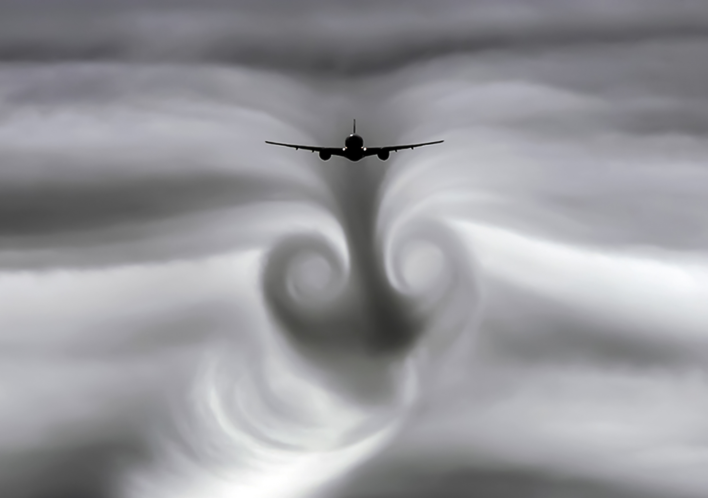
Airlines could face a bumpier and more unpredictable winter as a very strong El Niño takes hold across the Pacific Ocean.
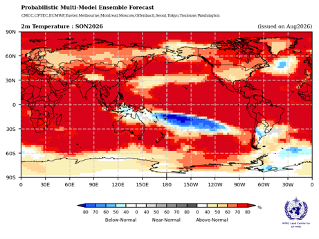
Forecasts from the World Meteorological Organisation (WMO) suggest the climate phenomenon will intensify in the coming months and carry on into early 2027.
The knock-on effects could be felt across global aviation and air travel, influencing everything from turbulence and flight times to airport operations and weather-related disruption.
What is El Niño and how does it affect global weather?
El Niño and La Niña are climate patterns which occur in the Pacific Ocean, and which can affect weather around the world.
Under normal conditions, trade winds push warm Pacific waters west towards Asia, allowing colder water to rise from the deep ocean near South America.
El Niño disrupts this pattern, while its opposite phase, La Niña, produces broadly contrasting conditions. Together they form the El Niño-Southern Oscillation (ENSO), a natural climate cycle that can influence weather, ecosystems and economies worldwide.
Events typically last nine to 12 months and occur every two to seven years, although there is no fixed schedule.
Recent exceptionally warm conditions in the Pacific Ocean have further intensified the weather pattern. A very strong El Niño can significantly shift rainfall and temperature patterns worldwide and fuel extreme weather.
Such is the extreme nature of the weather phenomenon that the WMO and National Meteorological and Hydrological Services have stepped up their preparedness for what they are calling an “exceptional event”.
How turbulence could get worse
According to SkyPath, a platform for turbulence and PIREP information, El Niño (and its cold counterpart, La Niña) “appear to change the windshear in the upper atmosphere. And it is wind shear that generates clear-air turbulence, which is particularly hazardous because it is invisible and undetectable by weather radar.”
SkyPath noted that using 40 years of atmospheric data, researchers calculated that windshear at flight cruising levels over the North Atlantic Ocean increases by around 35% when shifting from a very strong La Niña event to a very strong El Niño event.
The amount of turbulence in the skies over the North Atlantic has increased by around 30%, SkyPath said.
The impact on turbulence can be mixed however, with some regions benefiting from El Niño.
“Other regions affected by these increases include the USA, South America, South-East Asia, Australia, and Africa. Conversely, in East Asia, the relationship is flipped, and El Niño is found to decrease wind shear and turbulence, but La Niña is found to increase them,” the SkyPath analysis added.
“Large parts of the world could experience stronger windshear and increased turbulence probabilities in the year ahead.”
Turbulence was already getting worse before El Niño
The El Niño event comes off the back of a longer-term increase in North Atlantic clear air turbulence.
A peer-reviewed study published in Geophysical Research Letters analysed atmospheric data between 1979 and 2020 using 21 turbulence diagnostics.
Researchers from the University of Reading and Met Office found increases in CAT at aircraft cruising altitudes.
At an average point over the North Atlantic, the annual duration of light-or-greater CAT increased 17%, from 466.5 hours in 1979 to 546.8 hours in 2020.
Moderate-or-greater CAT increased 37%, from 70 hours to 96.1 hours annually. Severe-or-greater CAT increased 55%, from 17.7 hours to 27.4 hours annually.
How El Niño could change jet streams and flight times
El Niño can alter the position and strength of the jet stream by changing tropical heating and the circulation of the atmosphere.
During El Niño, the strongest parts of the jet stream typically shift south and extend farther east across the North Pacific, bringing the jet closer to North America.
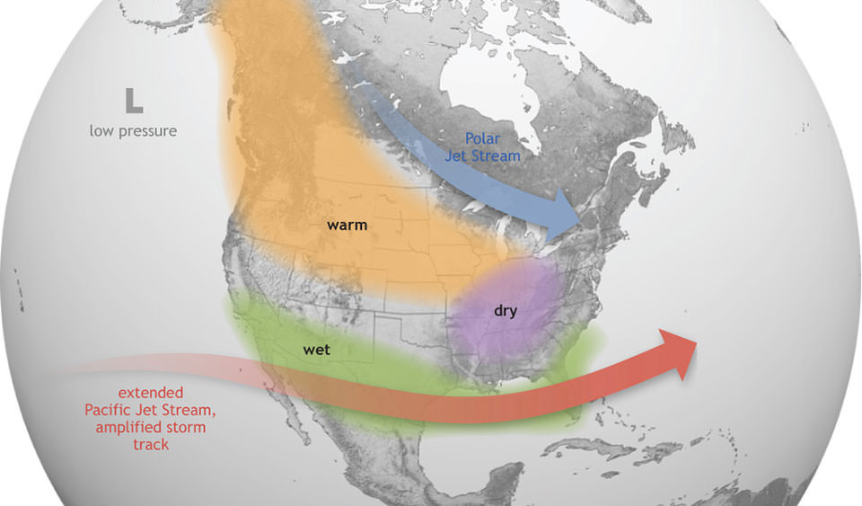
This altered flow can push storm systems across the southern third of the continent.
The result will likely be redirected storm systems and changing prevailing winds across flight routes, which will affect aircraft groundspeeds, fuel consumption and flight times.
How El Niño could impact hurricane season
One potential benefit for aviation is that El Niño typically suppresses Atlantic hurricane activity.
The phenomenon strengthens upper-level winds across the tropical Atlantic, increasing vertical wind shear that can disrupt developing storms and prevent them from becoming organised, according to the National Weather Service.
The NOAA expects El Niño to strengthen through the peak August–October period and is forecasting a 75% chance of a below-normal Atlantic hurricane season, with two to six hurricanes and zero to two major hurricanes.
However, El Niño does not eliminate the threat as NOAA says storms can still form, particularly in the subtropics and Gulf of Mexico, where conditions may remain more favourable.
Sign up for our newsletter and get our latest content in your inbox.


More from

October 17, 20265 min read


October 17, 20264 min read