

ICEYE unveils Gen5, the sharpest commercially built SAR satellite, with 11cm resolution

6 min read
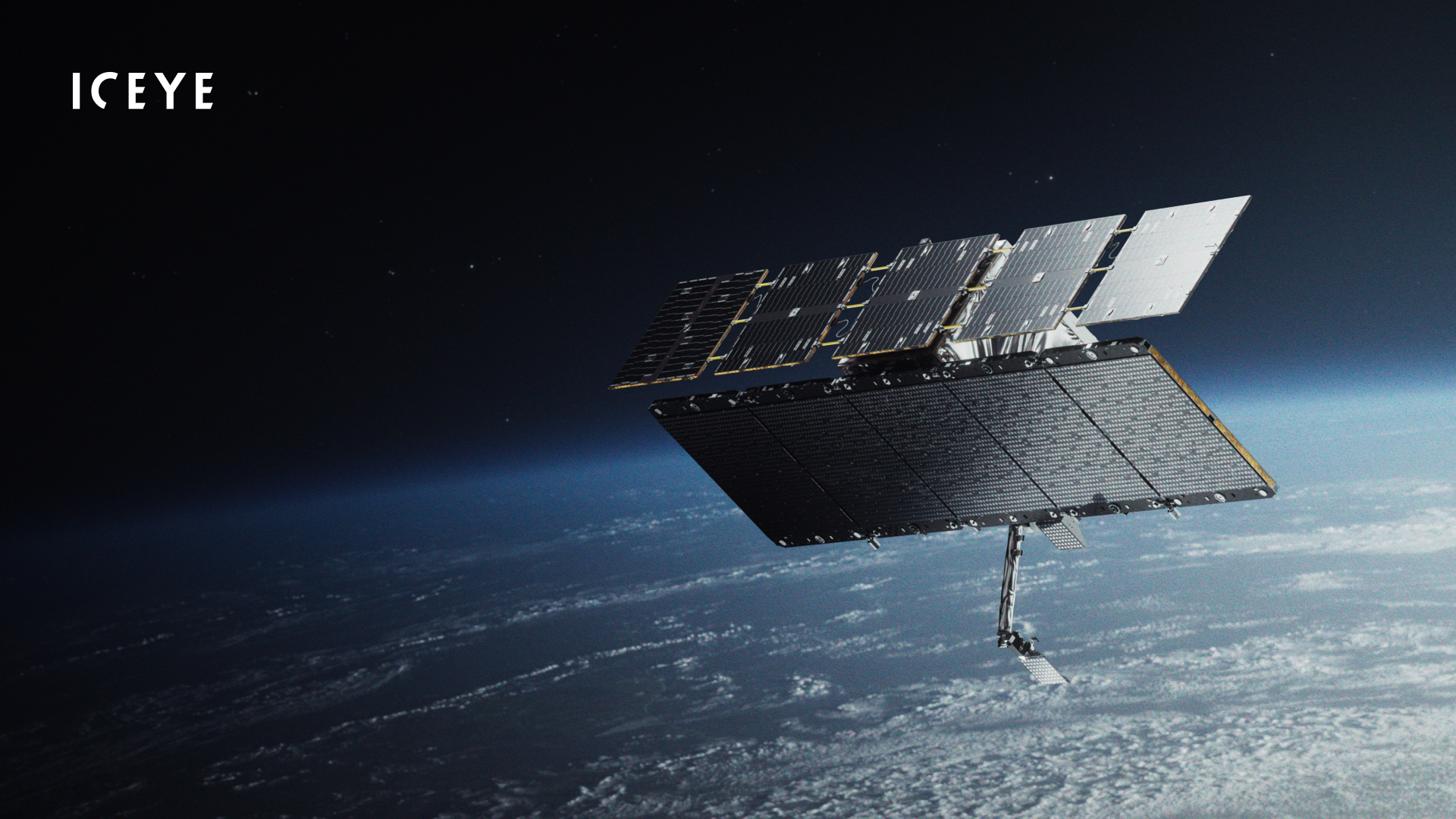

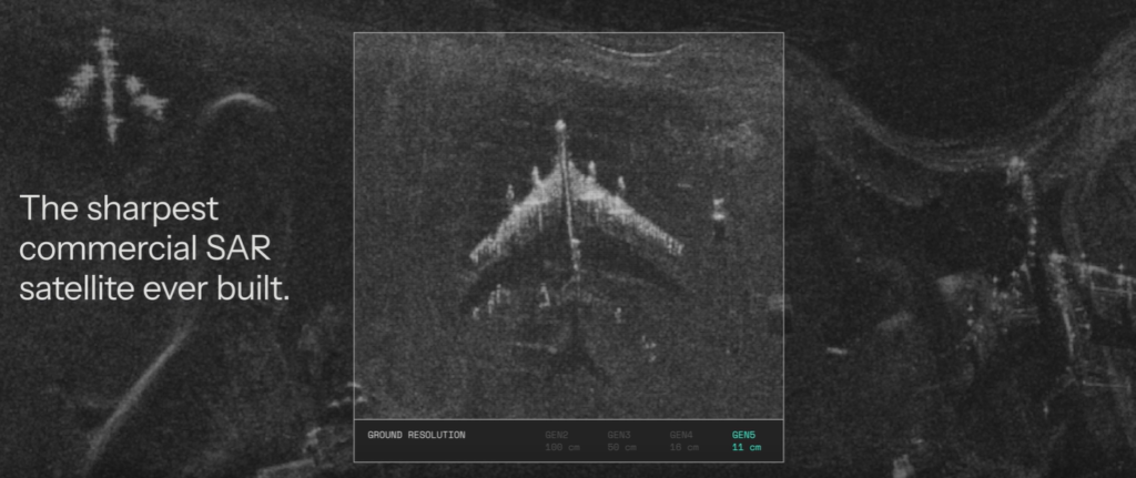
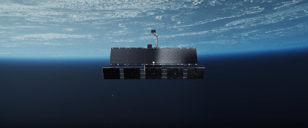
Finnish satellite manufacturer ICEYE has unveiled Gen5, its most advanced synthetic aperture radar (SAR) satellite yet, capable of capturing images with a resolution as fine as 11 centimetres, doubling imaging capacity and using onboard artificial intelligence to deliver critical information faster.
Announced on 16 November, the fifth-generation satellite is designed to provide governments, military operators and commercial customers with more detailed images, faster data delivery and the ability to monitor changes on the ground regardless of weather or daylight.
ICEYE describes Gen5 as the sharpest commercially built SAR satellite to date. Its highest-resolution mode, available to government customers subject to International Telecommunication Union (ITU) regulations, uses 1,800 MHz of imaging bandwidth to achieve the claimed 11cm resolution.
Commercial customers can access imagery with resolution as fine as 16cm using 1,200 MHz bandwidth.
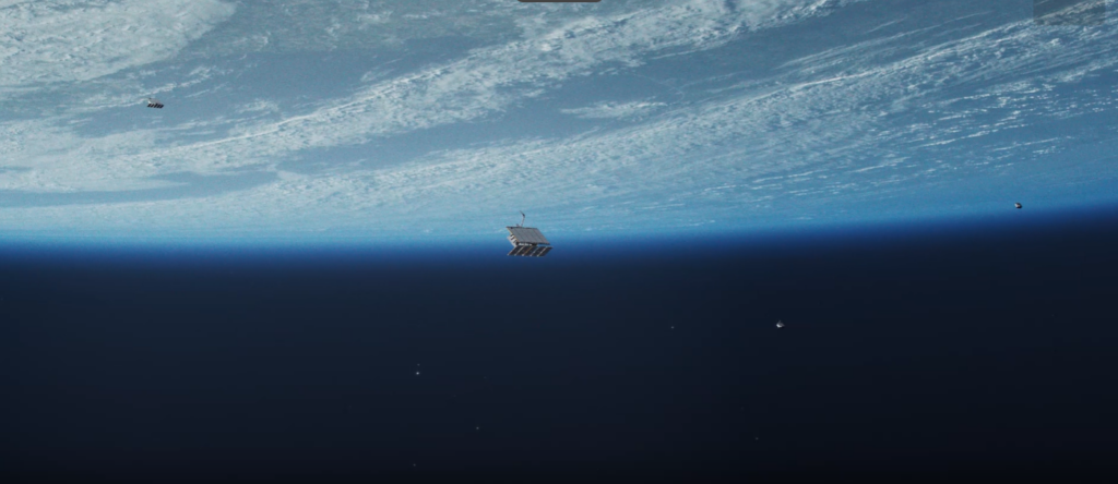
The announcement comes amid growing demand for satellite-based intelligence and heightened concern about the security of spacecraft in low Earth orbit. ICEYE itself was involved in a closely watched orbital encounter last month when a Russian satellite approached one of its radar-imaging spacecraft.
Unlike conventional Earth observation satellites, which rely on reflected sunlight, SAR spacecraft transmit radar signals towards Earth and measure the returning echoes. This allows them to image the surface at night and through cloud cover, smoke and adverse weather.
The technology is particularly useful for tracking military deployments, monitoring maritime activity, detecting changes at strategic installations and assessing damage following natural disasters.
Gen5 doubles imaging capacity and improves ground resolution
The new satellite offers several improvements over ICEYE’s earlier generations, particularly in the number of targets it can observe during a single orbital pass.
According to the company, Gen5 reduces the minimum separation between consecutive imaging windows by more than 30%, allowing it to capture targets positioned closer together along its orbital path.
It also provides twice the imaging time per orbit compared with previous ICEYE satellites.
The company says these improvements allow approximately 30% more images to be collected during each pass, increasing the amount of intelligence that can be obtained without adding more spacecraft.
Gen5 can acquire more than 18 images in a multi-image acquisition sequence.
Its imaging modes range from broad-area surveillance covering up to 120,000 square kilometres to detailed observation of individual locations within a 5km by 5km scene.
The highest advertised resolution is achieved at a radar incidence angle of 50 degrees. At 30 degrees, ICEYE specifies a ground resolution of 17cm, subject to ITU regulations.
These capabilities would allow analysts to examine smaller objects and identify changes that might not be visible in lower-resolution imagery.
Gen5 is designed to operate at altitudes between 450km and 600km.
Improved orbital control will allow the satellite to follow repeatable ground tracks, passing over the same location from approximately the same viewing angle on successive observations.
That consistency matters when comparing images taken on different days. Changes in the position of vehicles, equipment, vessels or infrastructure can be easier to distinguish when the viewing geometry remains similar.
ICEYE also says the spacecraft can raise its orbit more quickly after deployment, reducing the time spent reaching its intended operating position.
Artificial intelligence moves onto the satellite
Another major development is the introduction of an onboard AI processor.
Traditionally, Earth observation satellites collect imagery and transmit it to ground stations, where computers and analysts process the information.
Gen5 is designed to begin some of that work in orbit.
Its AI processor will support future capabilities including image screening, preliminary processing, autonomous object detection and classification.
The system is also intended to support tip-and-cue operations, in which the detection of an object or activity can help direct further observation.
ICEYE stressed that these AI capabilities will be introduced progressively through software updates rather than being fully available from launch.
The satellite runs on the company’s IceOS software platform, allowing new functions to be uploaded after deployment.
Data transmission has also been improved. Gen5 supports downlink speeds of up to 1 gigabit per second using a steerable antenna, twice the speed of its previous generation.
Rafal Modrzewski, ICEYE’s chief executive and co-founder, said faster intelligence delivery was central to the new design.
“Time to decision is everything in space-based intelligence, whether you’re tracking a vessel or responding to a flood. Gen5 shortens it at every step: sharper and more images per pass, and AI analysis that starts in orbit.”
He added: “With a new generation approximately every 18 months and new software releases every quarter, our customers’ systems keep gaining capability.”
Russian satellite encounter raises security concerns
The Gen5 announcement follows an incident in October involving Russia’s Kosmos-2612 satellite and ICEYE-X36, which drew attention from independent satellite trackers and commercial space surveillance companies.
As previously reported by Aerospace Global News, orbital observations between 15 and 19 October showed Kosmos-2612 approaching the ICEYE spacecraft in low Earth orbit.
Satellite tracking specialist Marco Langbroek, whose Sattrackcam observations helped document the encounter, reported close approaches estimated at approximately one to two kilometres, with some calculations suggesting the spacecraft may have passed considerably closer.
Commercial satellite imagery from Vantor, captured on 17 October, also documented the proximity of the two spacecraft, with an estimated separation of around one kilometre.
LeoLabs subsequently reported that the Russian spacecraft was drifting away from ICEYE-X36 by 18 October.
The observations raised questions about the purpose of the Russian satellite’s manoeuvres, although the available evidence did not establish that it intended to damage or interfere with the ICEYE spacecraft.
The encounter was significant because ICEYE operates a commercial radar-imaging constellation whose data can support military intelligence and surveillance.
Russia has previously demonstrated an interest in rendezvous and proximity operations involving satellites, activities that can serve legitimate inspection purposes but can also raise security concerns when conducted near another operator’s spacecraft without coordination.
There is no indication that the October encounter directly influenced Gen5’s development or announcement.
However, it illustrates the increasingly contested environment in which commercial Earth observation companies operate, particularly when their imagery supports defence and intelligence missions.
ICEYE offers governments their own satellite constellations
Beyond improved image quality, ICEYE is positioning Gen5 as a complete intelligence system that governments can operate independently.
The company says a sovereign Gen5 capability can be delivered within 12 months of contract signature, including satellites, ground infrastructure, software and operator training.
The system is described as ITAR-free, meaning it is not subject to US International Traffic in Arms Regulations.
Existing ICEYE customers can integrate Gen5 satellites into their current infrastructure without replacing ground systems or changing established satellite-tasking procedures.

This compatibility is important for governments seeking to expand surveillance capabilities without developing an entirely new operating system.
ICEYE, founded in Finland, has built a substantial commercial SAR constellation serving defence, intelligence, environmental monitoring, insurance and emergency management customers.
Its satellites are used for applications ranging from monitoring military activity to assessing flood damage and detecting changes in critical infrastructure.
Gen5 is the company’s fifth satellite generation in eight years, reflecting its strategy of introducing new hardware approximately every 18 months while continuing to upgrade spacecraft already in orbit.
ICEYE has not specified a launch date for the first Gen5 satellite in its announcement.
The new platform is intended to strengthen the company’s position in a market where governments increasingly want frequent, high-resolution satellite imagery without depending entirely on traditional national reconnaissance systems.
Sign up for our newsletter and get our latest content in your inbox.