What do nautical miles and knots mean and why are they used in modern-day aviation?


For as long as humans have travelled by sea and air, navigation has depended on reliable ways to measure distance and speed. As the early explorers sailed across oceans and, later, as aircraft began crossing continents, accurate methods of measuring distance and speed became increasingly important.
Two units that became fundamental to navigation are the nautical mile and the knot – originally maritime terms that are used as much today in aviation.

Unlike the statute mile or kilometres commonly used on land, these units are specifically designed to relate to the Earth’s geometry and curvature, and the practical needs of navigation.
Their development represents centuries of scientific observation, maritime tradition, and international standardisation.
Today, despite advances in satellite navigation and digital technology, the nautical mile and knot remain indispensable in both marine and aviation operations worldwide, and their use is as common as ever.
Yet, why is this the case, and why haven’t we moved on from this seemingly archaic terminology?
Understanding the nautical mile
A nautical mile is a unit of distance used primarily in maritime and aviation navigation. It is defined internationally as exactly 1,852 metres, or approximately 1.1508 statute miles.
The concept of the nautical mile originated from the Earth’s shape and its dimensions. Early navigators recognised that measuring distance based on the Earth’s curvature would be more practical for ocean travel than using land-based units.
The nautical mile was therefore linked to latitude and longitude, the coordinate system used to locate positions on the globe.

Both technically and historically, one nautical mile represented the distance corresponding to one minute of latitude along a meridian of the Earth. Since there are 60 minutes in one degree and 360 degrees around the Earth. This measurement created a convenient relationship between navigation charts and actual distances travelled.
In simple terms, the nautical mile was useful because one minute of latitude corresponded closely to one nautical mile, making it easier to relate chart positions to real-world distances.
What is the origin of the word ‘knot’?
A knot is a unit of speed equal to one nautical mile per hour. For example, a ship travelling at 20 knots covers 20 nautical miles in one hour.
The term knot has a fascinating historical origin. During the sixteenth and seventeenth centuries, sailors needed a practical method to estimate a ship’s speed while at sea to calculate the distance travelled during a set period of time. They developed a device known as the ‘chip log’ or ‘log line’.

This consisted of a rope attached to a wooden board. Knots were tied in the rope at regular intervals. Sailors would throw the board overboard and allow the rope to run out while timing the process with a sandglass. The number of knots that passed through a sailor’s hands during a fixed time interval indicated the ship’s speed.
Because speed was measured by counting actual knots on the rope, the unit eventually became known simply as a ‘knot.’ Although modern technology has replaced this original method of measuring speed, the terminology remains in use today.
Early navigation and maritime exploration relied on these measurements
The development of the nautical mile and knot coincided with the great age of maritime exploration. Between the 15th and 18th centuries, European exploration superpowers such as Portugal, Spain, Britain, and the Netherlands launched voyages that transformed geography and global trade.
Navigators originally relied heavily on celestial observations, maps, compasses, and dead reckoning. Since latitude could be measured using the Sun or stars, a distance unit linked directly to latitude proved extremely useful. Mariners could easily relate chart measurements to actual travel distances.
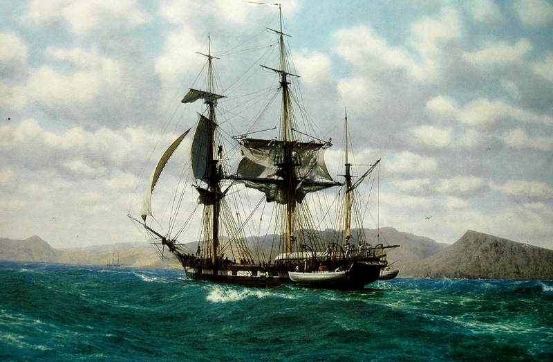
The knot became equally valuable because it allowed captains to estimate their position between observations. By knowing their speed and direction, they could calculate how far they had travelled.
Although not perfectly accurate, these calculations significantly improved long-distance navigation, which, up until that time, had relied on little more than rudimentary estimations.
Scientific refinement of the units in the 19th century
By the 19th century, advances in astronomy, cartography, and geodesy led to more precise measurements of the Earth. Scientists realised that the Earth was not a perfect sphere, but what is known as an ‘oblate spheroid’, meaning that the length of a minute of latitude varied slightly depending on location on the Earth’s surface.
Different countries consequently adopted slightly different definitions of the nautical mile. For example, British, American, and French navigators often all used values that differed by several metres.

These inconsistencies occasionally created confusion in international navigation. However, the basic principle remained unchanged – the nautical mile continued to be associated with the Earth’s geometry and geographic coordinates.
The 19th century also saw the expansion of steam-powered ships. As maritime commerce increased, accurate speed and distance measurements became even more important for scheduling, safety, and navigation, paving the way for the growth of long-distance passenger oceanic travel for the first time.
The 20th century and the rise of global aviation
The 20th century introduced a new challenge as aviation began to develop. As aircraft began flying over increasingly longer distances and specifically over oceans, pilots required navigation methods that were compatible with maritime systems.
Because aviation navigation also relied heavily on latitude, longitude, and chart plotting, the nautical mile proved ideal for air travel and was widely adopted as the standard unit of measurement. The knot naturally followed as the preferred speed measurement.
Aircraft speed, wind velocity, and navigation calculations became standardised using knots and nautical miles. This consistency allowed pilots and air traffic controllers around the world to communicate using a common system with uniform terminology.
Even countries that use kilometres for road transportation often employ nautical miles and knots for aviation. This international standardisation reduces confusion and enhances safety in global air operations, even in areas where air transport remains uncommon.
International standardisation of the terminology
A major milestone came in 1929, when the First International Extraordinary Hydrographic Conference in Monaco adopted the international nautical mile of 1,852 metres. This value was based on the average length of one minute of latitude and provided a consistent measurement for all nations.
Over time, more countries accepted this definition. The United States formally adopted the international nautical mile in 1954, while the United Kingdom followed in 1970. The international knot became officially defined as one nautical mile per hour, creating a universally accepted system for measuring speed and distance both at sea and in the air.

Standardisation was particularly important as international shipping and aviation networks expanded throughout the 20th century. A common measurement system reduced misunderstandings, allowed for greater accuracy in timetable planning, and improved the operational efficiency of global aviation systems.
The importance of this terminology in modern-day aviation
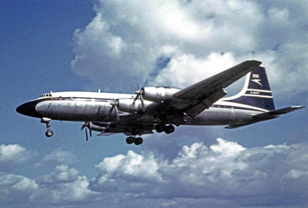
Aviation remains one of the most significant users of nautical miles and knots. Aircraft navigation systems, flight planning software, and air traffic control procedures are all based on these measurements.
Distances between airports are frequently expressed in nautical miles, while aircraft speed is measured in knots. Commercial aircraft commonly cruise at speeds between 450 and 500 knots, although higher speeds are often referred to under certain circumstances as Mach numbers, which express an aircraft’s speed as a ratio of the local speed of sound.
Wind forecasts are also reported in knots, allowing pilots to calculate groundspeed and fuel consumption accurately. Since aviation is inherently international, maintaining a single navigation standard helps prevent errors and facilitates communication between pilots and air traffic controllers worldwide.

Modern technologies such as GPS have greatly improved navigation accuracy, but they commonly display and operate with nautical miles and knots because these units remain intricately linked to geographic coordinates.
The importance of these units extends to flight planning and air traffic management. Distances between geographic waypoints, airports, and navigation aids are measured in nautical miles, while aircraft performance data and separation standards often rely on knots.
For example, controllers may instruct an aircraft to maintain a certain speed in knots to ensure safe spacing between aircraft on approach to an airport.
Even with advanced satellite navigation systems such as GPS, nautical miles and knots remain the international standards used by aviation organisations, including the International Civil Aviation Organization (ICAO).
Their continued use promotes accuracy, safety, and global interoperability, enabling efficient air travel across national boundaries and different aviation systems.
The use of old terminology despite living in the digital age
Many people have questioned whether kilometres and kilometres per hour might eventually replace nautical miles and knots, and the topic remains under regular debate. However, despite the widespread adoption of the metric system, nautical units remain deeply embedded in navigation.
Modern GPS receivers, electronic chart systems, radar equipment, and flight management computers are all designed to work seamlessly with nautical miles and knots. International regulations, training programmes, and operational procedures also rely on these units.

Furthermore, the relationship between the nautical mile and the Earth’s coordinate system makes it especially convenient for navigation. This practical advantage ensures its continued relevance even in the digital age.
More than just useful terms of measurement
The nautical mile and the knot are more than simple units of measurement. They are products of centuries of navigational experience and scientific development.
Originating from the Earth’s geometry and the practical needs of the early sailors, these units helped explorers cross oceans, enabled the growth of global trade, and later became essential to aviation.

Through international standardisation and technological advancement, both terms, which sit hand-in-hand with one another, have remained remarkably resilient.
Today, whether guiding a cargo ship across the Atlantic or directing an aircraft through international airspace, the nautical mile and knot continue to provide a universal language for navigation.
Their enduring use demonstrates how historical innovations can remain valuable even in an age dominated by advanced technology and satellite navigation.
Featured image: Maksim Denisenko / stock.adobe.com


