


NASA uses drone to test autonomous Moon and Mars landing technology

5 min read
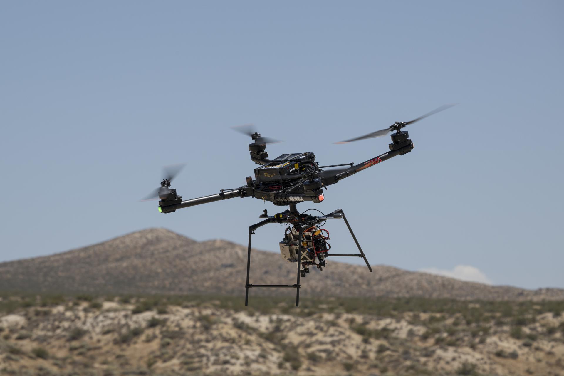
NASA has successfully tested a navigation system that allows an aircraft to identify hazardous terrain and change its landing approach, a capability being developed to help future spacecraft land safely on the Moon and Mars.
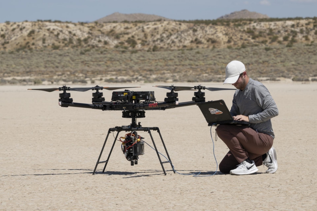
The experiment used an Alta-X drone carrying NASA’s Safe and Precise Landing – Integrated Capabilities Evolution (SPLICE) system. The aircraft performed simulated lunar descent and landing manoeuvres over Rogers Dry Lake near the agency’s Armstrong Flight Research Center in Edwards, California, on 27 August.
NASA announced the results on 4 November, saying the technology had demonstrated its ability to assess potential landing sites and guide a vehicle towards safer terrain.
The system uses sensors to build detailed maps of the ground during descent. If its guidance software identifies an unsafe landing area, it can calculate a different approach and direct the aircraft towards an alternative site.
The test is part of NASA’s effort to develop autonomous landing capabilities for future robotic and crewed missions, particularly those targeting areas where rocks, craters and steep slopes make conventional landings difficult.
What is SPLICE?
SPLICE is a collection of navigation sensors, computers and guidance software designed to help spacecraft determine where they are, identify obstacles and land accurately without relying entirely on instructions from Earth.
Development began in 2017, building on earlier NASA research into autonomous landing and hazard avoidance.
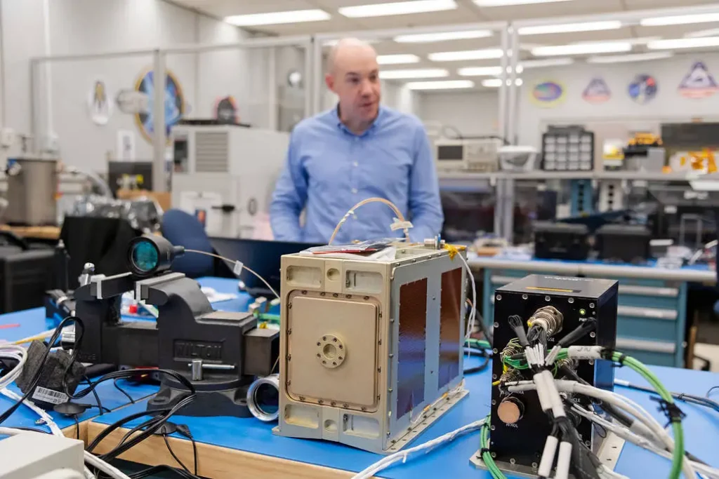
The system brings together several technologies that perform different tasks during a spacecraft’s descent.
One is terrain-relative navigation, which uses a camera to photograph the surface and compare the images with maps previously obtained by orbiting spacecraft.
By matching visible features with those maps, the lander can establish its position and navigate towards a selected destination.
Another component, Navigation Doppler Lidar, uses laser beams reflected from the surface to measure the spacecraft’s altitude and velocity.
NASA says the lidar provides more precise measurements than conventional radar landing sensors while requiring less mass and power.
The system also includes Hazard Detection Lidar, which scans the terrain and produces a three-dimensional map of the landing area.
A descent and landing computer processes the information from the sensors, identifies potential hazards and calculates a suitable landing location.
NASA is also developing adaptive guidance software capable of changing the spacecraft’s trajectory if the original landing site proves unsuitable.
These capabilities are intended to operate together during the final stages of descent, when a spacecraft has limited time to identify obstacles and make corrections.
A decade of development
The August demonstration followed several months of testing involving engineers from NASA’s Johnson Space Center in Houston and Armstrong Flight Research Center in California.
Researchers at Johnson developed the SPLICE payload, while Armstrong specialists helped integrate it with the Alta-X drone and conduct flight tests.
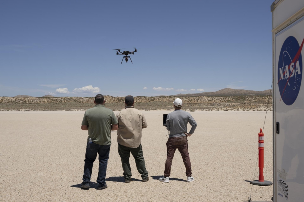
Initial flights in June and July examined communications, telemetry, data handling and command-and-control functions.
During a 15 July flight, the payload successfully communicated with the remotely piloted drone while it performed hovering manoeuvres.
The subsequent August test examined the guidance system during simulated lunar descent and landing conditions.
“This flight test is the culmination of almost a decade of work, for the SPLICE project,” said Davis Adams, NASA’s SPLICE project manager.
“This flight raised the technology readiness level, priming it for integration into future robotic and crewed lunar flights. Validation of the guidance and navigation systems are applicable to terrestrial, lunar, and Martian descent and landing missions.”
NASA’s earlier work included tests aboard suborbital rockets and helicopters.
In 2014, precursor landing sensors flew aboard the agency’s Project Morpheus rocket. Further tests followed on Masten Space Systems’ Xodiac rocket in 2017 and 2019.
A rocket sled experiment in California in June 2019 tested Navigation Doppler Lidar at speeds approaching 480mph.
More recently, NASA conducted helicopter testing of its hazard detection equipment and landing computer in March 2025.
The agency also carried out closed-loop drone testing at Voyager Technologies’ Lunar Surface Proving Grounds in Mojave, California, in August 2026, examining its adaptive guidance and terrain navigation systems.
NASA’s project records list September 2026 as the SPLICE project closeout milestone.
Why precise landings matter
Landing on the Moon presents challenges that are difficult to reproduce on Earth.
Spacecraft must descend towards unfamiliar terrain while identifying hazards and maintaining control of their speed and position.
During the Apollo missions, astronauts relied partly on visual landmarks to determine their position and assess potential landing areas.
SPLICE is intended to perform much of that work automatically.
Its terrain-relative navigation system can compare live camera images with stored maps, while lidar sensors measure altitude, velocity and surface conditions.
NASA says its hazard detection system is designed to begin scanning the surface at an altitude of approximately 500 metres, generating detailed terrain information to help select a safe touchdown area.
This could allow future spacecraft to land closer to scientifically valuable locations, reducing the distance astronauts or robotic vehicles must travel after landing.
Such capabilities are particularly relevant to missions near shadowed lunar craters and other difficult terrain.
NASA is also examining applications for Mars, where communication delays prevent controllers on Earth from making immediate decisions during a spacecraft’s final descent.
Commercial lunar landers could benefit
NASA has been working with commercial lunar lander companies to incorporate technologies developed through SPLICE into future spacecraft.
The agency says several planned lunar missions are expected to use information obtained during the programme to support precision landing.
“We are coordinating with industry regarding the usage of the guidance system once the system is available in the NASA software catalog, currently planned for this fall,” Adams said.
“Some of the companies also are evaluating the system’s navigation capabilities for precision landing applications, as well as potential extensions for autonomous surface mobility.”
The SPLICE programme has involved several NASA centres, including Johnson, Armstrong, Langley, Goddard and the Jet Propulsion Laboratory, alongside engineering company Draper.
The work has been funded through NASA’s Game Changing Development programme within its Space Technology Mission Directorate.
Although the latest flight took place over a dry lakebed in California, the technology is being developed for destinations where a spacecraft must make its own landing decisions, potentially far beyond the reach of immediate human intervention.


