NASA and ISRO launch NISAR satellite to monitor tiny changes in Earth’s environment

July 30, 2025

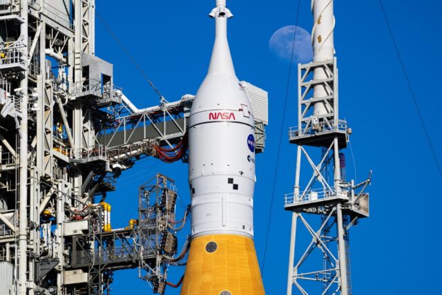
India and the United States have marked a major milestone in space collaboration with the successful launch of NISAR, the world’s first Earth observation satellite equipped with dual radar systems.
The satellite was launched onboard ISRO’s GSLV-F16 from the Satish Dhawan Space Centre in Sriharikota in southern India, at 5:40 pm local time, and placed into a 734 km Sun-synchronous orbit after a smooth 19-minute flight.

NASA confirmed the signal was successfully acquired shortly after. “Mission controllers for the NASA-ISRO NISAR (NASA-ISRO Synthetic Aperture Radar) mission have received full acquisition of signal from the spacecraft,” it reports.
This marks the first time ISRO’s GSLV rocket has delivered a satellite into a Sun-synchronous polar orbit, typically the domain of PSLV-class launchers, highlighting India’s advancing heavy-lift and cryogenic capabilities.
What is NISAR and what will it do?
The NASA-ISRO Synthetic Aperture Radar (NISAR) satellite weighs 2,392 kg and is the most expensive Earth observation satellite ever built, with a cost of around $1.5 billion. ISRO contributed over ₹4.7 billion ($53.6 million) towards its development.
What makes NISAR unique is its dual-frequency radar system: NASA’s L-band and ISRO’s S-band radars work in tandem, capturing high-resolution images in all weather conditions and at any time of day. Together, they can detect surface changes as small as one centimetre.
Earth's surface is in motion: earthquake faults slip, crops grow, levees crumble, glaciers retreat.
— NASA (@NASA) July 30, 2025
A joint NASA/@ISRO radar satellite, NISAR, launched today to measure land and ice land and ice changes like these to within a fraction of an inch: https://t.co/NGDTpBBgb7 pic.twitter.com/CvLKuhZJIJ
NISAR is designed to help the world adapt to climate change and natural disasters. It will track land deformation, monitor aquifers and reservoirs, and map ice sheet dynamics in places like Greenland and Antarctica.
Orbiting the Earth every 12 days, it will monitor:
- Retreating glaciers and sea ice
- Forest cover and vegetation shifts
- Earthquakes, landslides, and volcanoes
- Soil moisture and crop patterns
- Surface water bodies and coastline movement
“The satellite will benefit India, the US, and the entire world… It is also crucial for monitoring the Earth’s natural resources,” says ISRO Chairman V Narayanan.

India’s Minister for Space, Dr Jitendra Singh, called the mission a “game-changer” and noted its global benefits. “NISAR will not only help manage disasters like cyclones and floods but also serve aviation, shipping, and agriculture sectors,” he says.
Importantly, NISAR’s data will be freely available to scientists, agencies, and governments, typically within 1–2 days, and in near real-time during emergencies.
A strong partnership for global scientific benefit
NISAR showcases the strength of the NASA–ISRO partnership, blending complementary capabilities to deliver a mission with global scientific impact.
NASA provided:
- L-band radar system
- 12-metre unfurlable antenna
- GPS receivers and telecommunication hardware
And ISRO contributed:
- S-band radar
- Spacecraft bus
- GSLV-F16 rocket and launch operations
The radars were independently developed and later integrated at NASA’s Jet Propulsion Laboratory (JPL). Final assembly and testing took place at ISRO’s URSC in Bengaluru.

Now in orbit, NISAR enters the deployment phase, where its 12-metre antenna will be extended via a 9-metre boom, developed by JPL.
This will be followed by a 90-day commissioning phase, which involves rigorous calibration of both radars and other spacecraft systems.
Full science operations will begin after that and continue for the mission’s planned three-year life or longer, depending on its health.
Dr Jitendra Singh says, “This mission symbolises what two democracies committed to science and global welfare can achieve together.”
NISAR launched on GSLV-F16 with an indigenous cryogenic upper stage
Originally scheduled for 2024, the launch was delayed due to a technical issue with the satellite’s large antenna. The system was sent back to the US for rectification before final integration in India.
Now successfully in orbit, NISAR signals India’s arrival as a key global player in advanced Earth observation and highlights the strength of international cooperation in space.

GSLV-F16 marks the 18th flight of India’s Geosynchronous Satellite Launch Vehicle and the 12th to use an indigenous cryogenic upper stage, demonstrating ISRO’s continued focus on self-reliance in advanced propulsion.
The indigenous cryogenic upper stage is a major milestone for India because it enables ISRO to launch heavier payloads into higher orbits without relying on foreign technology, something that was once blocked by international sanctions.
Using super-cooled liquid hydrogen and oxygen, the stage delivers higher efficiency and thrust than earlier propulsion systems, making it essential for complex missions like NISAR.