FAA study reveals hundreds of drones in the US are breaking rules and risking aviation safety


The increasing number of drones operating in US airspace, many exceeding authorised altitude limits and flying near airports, has elevated the risk of mid-air collisions with manned aircraft, presenting a significant safety challenge.
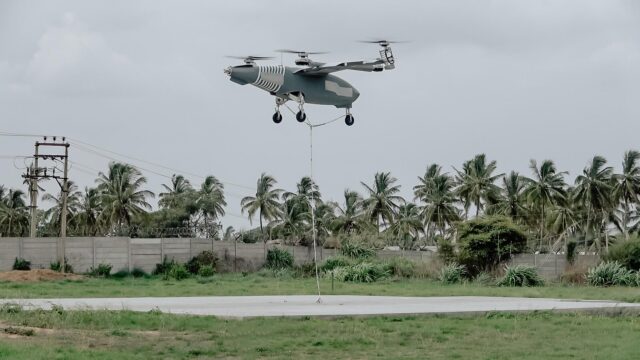
With their rapid rise in recreational, commercial and emergency service use, small uncrewed aircraft systems (sUAS) are beginning to intersect with traditional aviation in ways that demand closer scrutiny.
A comprehensive study led by researchers at Embry-Riddle Aeronautical University in the United States has revealed notable growth in drone usage across the country, alongside a range of safety concerns related to their operation within airspace also used by manned aircraft.

The analysis, commissioned by the Federal Aviation Administration (FAA), assessed patterns of small uncrewed aircraft systems (sUAS) activity of drones weighing under 55 pounds, using Remote Identification (Remote ID) signals.
This technology has been mandated in the US since 2023 and enables authorities to track registered drones and analyse their flight behaviour.
Hundreds of drones operating above permitted altitudes
The data showed that a significant number of drones are operating above the FAA’s 400-foot ceiling for routine drone flights. Out of 6,037 flights with altitude data, over 1,350 exceeded this limit. Specifically, at least 781 flights reached 500 feet or more.
According to Dr Ryan Wallace, the project’s lead investigator, many of these flights likely fall outside FAA approval, although some may have operated under waivers or special authorisations.
The researchers calculated that roughly 10% of total observed drone flying time took place in airspace traditionally used by manned aircraft.
Flights above 500 feet were most likely recreational rather than commercial, based on the drone models in use.

The study also found that drone operations often occur near aerodromes, with particular concern around heliports, which are typically not marked on standard aeronautical charts and are often located within urban areas.
Some sUAS flights were detected within half a nautical mile (approximately 3,000 feet) of heliports, raising the risk of conflict with low-flying helicopters.
To mitigate these risks, the report recommends incorporating heliport locations into aviation charts to improve awareness among drone operators.
Most drone flights analysed were short (under 35 minutes), occurred during daylight hours, and took place in calm weather conditions. While this limits exposure time, it also reduces opportunities for authorities to intervene when unsafe practices occur.
Not all drone flights are trackable
The research highlighted several technical limitations. Remote ID detection was only effective within a limited range, suggesting that current tracking technology is not yet suitable for comprehensive surveillance.
Additionally, many drone flights go unrecorded due to the lack of a centralised, real-time tracking system for all sUAS operations. This could mean the issue is more widespread than the study suggests.

Researchers recommend improvements such as broadcasting sUAS alerts to manned aircraft, updating FAA guidance on collision avoidance, and including training via the FAA WINGS programme.
The findings are intended to guide the upcoming ASSURE A83 project, which aims to refine drone traffic analysis and support safer integration of UAS into the National Airspace System.
As drone applications continue to expand in areas such as inspection, emergency response, and potentially package delivery, the researchers stress that clear policy, improved technology, and continued monitoring are necessary to ensure safety and coexistence in increasingly crowded skies.