Modified Gulfstream G550 heads to New Zealand to study clouds in the cleanest environment on Earth

September 5, 2025

With concerns over global warming and atmospheric pollution high on the worldwide agenda, research is advancing in these fields at a staggering pace.
Now, a group of German scientists has embarked on a new mission to the Southern Ocean using a modified Gulfstream G550 business jet. The mission aims to discover what pollutants exist in the cleanest environment on the planet and how the atmosphere and clouds may react to declining emissions in the coming decades.
To find the answers to these and many other questions, the German Aerospace Centre (Deutsches Zentrum für Luft-und Raumfahrt, or DLR) is supporting a group of researchers led by the Leibniz Institute of Tropospheric Research (TROPOS) in the HALO-South mission.
What exactly is the aircraft, and what can it do?
Starting in September 2025, the HALO (High Altitude and Long Range) research aircraft will spend 176 flight hours investigating the interaction of clouds, aerosols, and radiation over New Zealand and specifically over the Southern Ocean.
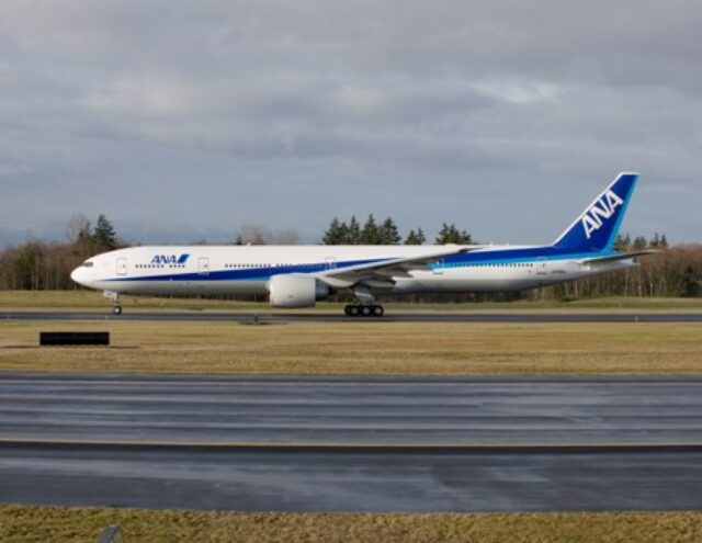
The HALO research aircraft is based on a Gulfstream G550 ultra-long range business jet and carries the registration D-ADLR.
“The combination of range, cruising altitude, payload, and comprehensive instrumentation makes the aircraft a globally unique research platform,” DLR says.

According to data from Flightradar24, the HALO set off from its base in Oberpfaffenhofen, Germany, on 2 September and routed via Memmingen, Muscat, Kuala Lumpur, and Cairns. It is due to arrive at its new temporary base in Christchurch, New Zealand, on 6 September.
Details of the HALO New Zealand project
For five weeks, HALO will operate out of Christchurch, carrying out measurement flights over the oceans of the southern hemisphere. DLR states that as the air around Antarctica remains relatively clean and pollution-free, this allows the researchers travelling on board HALO to analyse data obtained from the air from a “lower emission world”.
The mission marks the start of a research collaboration between Germany and New Zealand, the organisation added.
“The region is one of the cloudiest on Earth and differs in key ways from the Northern Hemisphere, which has been more extensively researched for climate models,” added the DLR statement. “Due to fewer land masses, lower population density, and less industry, the atmosphere here is significantly cleaner than in the north.”
“As such, there are fewer particles to form cloud droplets and ice crystals, meaning fewer clouds are expected to consist purely of ice particles or coexisting ice particles and liquid droplets.”

Up until now, the majority of climate modelling research has been conducted using air samples obtained over the significantly more polluted Northern Hemisphere.
However, there remains a lack of data from the Southern Hemisphere. Now, the HALO-South project aims to rectify this discrepancy by collecting data from the Southern Ocean, closing the gap and allowing for more advanced and accurate modelling techniques to be employed.
For the first time on a mission of this type, the research flights will also measure the number of ice nuclei in parallel with the number of cloud particles.
“This data is crucial to better understand ice multiplication processes and their impact on cloud formation,” added DLR.
Approximately 50 researchers will participate from various institutions, including the Leibniz Institute for Tropospheric Research (TROPOS), the Leipzig Institute for Meteorology at Leipzig University, Goethe University Frankfurt (GUF), the Karlsruhe Institute of Technology (KIT), and the DLR Institute of Atmospheric Physics.
The University of Canterbury in Christchurch and MetService New Zealand will also participate with ground-based measurements. The aircraft itself will be operated by the DLR Flight Experiments facility.
HALO to measure aerosol properties and cloud structures
Prior to the mission, the HALO research aircraft was equipped with five highly sensitive cloud-measuring instruments that record the size, number, and shape of cloud particles.
Additional instruments located both outside and inside the aircraft are used to measure aerosols (the tiny particles of matter suspended in the air).
According to the DLR, these measurements are crucial because aerosols act as seeds for cloud droplets (depending on their size). Under normal atmospheric conditions, clouds cannot form without aerosols.

“Sensors under the wing and on a windowpane measure particle ranging from approximately one micrometre to six millimetres in size, covering almost the entire size range of natural clouds,” explained Christiane Voigt from the DLR Institute of Atmospheric Physics.
“Two of the measuring instruments also provide high-resolution images that can be used to determine the phase state, that is, whether the particles are ice or supercooled water droplets.”
A Japanese satellite is assisting with the project
Further support for the research project will be supplied by the Japanese Himawari weather satellite. Its data will be combined with HALO’s designated flight path will provide the research team with real-time information on cloud types and aerosol quantities along the route.
Armed with this information, flight planners will be able to respond directly to current conditions, such as when warm, supercooled, or icy clouds form in a region, or when cloud-free areas present opportunities for aerosol measurements.
With the HALO aircraft due to arrive in Christchurch imminently, the research project is expected to begin in the second week of September, with the aircraft due to return to its home base with DLR in Germany by mid-October.
Aircraft have been used for atmospheric surveillance before
The HALO follows in a long line of aircraft that have been used for this type of mission in the past. Given their ability to fly high above the air closest to the earth’s surface, aircraft provide an ideal platform to carry out experiments outside of the lower atmosphere, where pollution is at higher levels and possibly may not provide the most accurate or useful data to scientists.
High-altitude aerial platforms that have been used in the past include NASA’s ER-2 jet. This high-altitude aircraft is a modified U-2 reconnaissance aircraft and can fly for around ten hours, and has a 6,000-mile range.

It is designed to operate above 99% of the Earth’s atmosphere, reaching altitudes of up to 70,000 feet. The two ER-2 (‘Earth Resources 2’) aircraft carry sophisticated sensors to study Earth’s climate, climate change, and to test prototype satellite imaging sensors.
In the UK, the FAAM (a research body set up through a collaboration between the UK Meteorological Office and the Natural Environment Research Council) uses a British Aerospace 146 quad jet to serve as an “airborne laboratory” for atmospheric research.
It carries extensive scientific equipment for a wide range of studies, including air pollution, climate change monitoring, and weather.

Also in the UK, the Cambridge-based British Antarctic Survey uses its De Havilland Canada Twin Otter for atmospheric studies. With its short takeoff and landing capability (STOL) as well as the ability to operate off ice airstrips, the versatile aircraft is used for atmospheric studies, boundary layer studies, and cloud/aerosol studies in remote and polar regions, including the Antarctic and Arctic.
Lastly, in the US, the University of Wyoming uses a modified Beechcraft King Air, equipped with new lidars, radars, and atmospheric chemistry equipment to support various atmospheric studies.


