NOAA Hurricane Hunters forced to cut short Melissa mission after severe turbulence


Hurricane Melissa is now so strong that even NOAA’s Hurricane Hunter aircraft had to leave early due to extreme turbulence. NOAA and the Air Force continue to monitor the hurricane as it barrels across the Caribbean.
NOAA’s Hurricane Hunter forced to leave Melissa early
On Monday, the National Oceanic and Atmospheric Administration (NOAA) stated, “NOAA aircraft left the storm early after experiencing severe turbulence in the SW eyewall.”
Insane footage from inside the eye of now Category 5 Hurricane Melissa, taken during one of yesterday’s recon flights by a U.S. Air Force WC-130J Weatherbird with the 53rd Weather Reconnaissance Squadron based out of Biloxi, Mississippi. pic.twitter.com/gGup2zgsdE
— OSINTdefender (@sentdefender) October 27, 2025
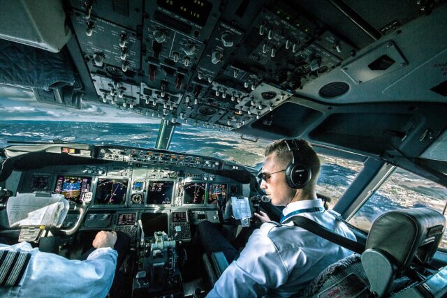
NOAA’s Hurricane Hunters are designed to fly into storms and hurricanes to collect weather information. These aircraft are highly modified P-3 Orion maritime patrol aircraft designated Lockheed WP-3D Orion.
They can operate in extreme stormy environments. Noah Bergren, a senior meteorologist at Fox 35 Orlando, posted on Facebook, “Hurricane hunters rarely leave. Melissa is that bad.”
NOAA did not specify which aircraft were forced out of the hurricane. In an update on the storm, NOAA stated it had gathered information from an “Air Force Reserve Hurricane Hunter aircraft,” without explicitly saying whether this was the same aircraft that was forced to leave.
This might be a reference to the USAF’s modified WC-130J aircraft, rather than its WP-3D Orions. Both aircraft are dubbed “Hurricane Hunters.” Photos and videos released appear to show an Air Force WC-130J flying through Melissa instead of a NOAA Orion.
NOAA is not the only organisation to operate Hurricane Hunters. The US Air Force Reserve 53rd Weather Reconnaissance Squadron is the world’s only military weather reconnaissance unit. It operates a fleet of ten Lockheed WC-130J aircraft that fly directly into hurricanes all the way to the eye.
Hurricane Melissa could be the strongest on record to strike Jamaica
Hurricane Melissa is now a Category 5, meaning it tops the Saffir-Simpson hurricane scale. The hurricane is generating sustained winds as fast as 175 mph, and it threatens to be the most powerful hurricane in history to hit Jamaica.
Yeah, this is wild.
— Tanner Charles 🌪 (@TannerCharlesMN) October 27, 2025
Screen grabs from the Hurricane Hunters videos of Melissa. #hurricanemelissa pic.twitter.com/YF7oAtLXqJ
NOAA stated that there is no practical difference in the impact of Melissa making landfall at Category 4 or 5 intensity, as both are catastrophic. It is predicting the hurricane will be disastrous in Jamaica, Haiti, and the Dominican Republic. For eastern Cuba, it is expected to bring heavy rainfall with potentially devastating flash flooding.

Yesterday, NOAA stated there are no obvious signs that Melissa has weakened. It added that its Hurricane Hunter aircraft and United States Air Force Reserve aircraft will return and investigate Melissa in the next few hours.
NOAA to replace its Hurricane Hunters
NOAA’s Lockheed WP-3D Orion Hurricane Hunters are unique, with only two of these aircraft in existence. The Orion is the military variant of the Lockheed L-188 Electra, which first flew in 1957.

The WP-3D Orion is now an ageing platform and has been in service since the 1970s. Around the world, navies are retiring their fleets of P-3 Orion aircraft and are generally replacing them with the Boeing P-8 Poseidon maritime patrol aircraft.
✈️🌊 TEAL77 departed this morning for Hurricane Lorena in the eastern Pacific.
— Hurricane Hunters (@53rdWRS) September 3, 2025
Their data helps the National Hurricane Center improve forecasts, protecting lives & property!#HurricaneHunters #AFReserve #IntoTheStorm pic.twitter.com/cxDqT2O6SW
In September 2024, NOAA awarded a contract to Lockheed Martin for two Lockheed Martin C-130J Super Hercules to replace the two Orions. The Super Hercules is the aircraft the USAFR 53rd uses for a similar mission. The Orions are expected to continue in service until they are placed by the Super Hercules in 2030.
In all, NOAA operates a fleet of ten crewed aircraft. Besides the two Lockheed WP-3D Orion Hurricane Hunters, four De Havilland Canada DH-6 Twin Otters, one Gulfstream IV, and three Beechcraft King Air aircraft. The Gulfstream IV is a high-altitude hurricane research and atmospheric river research aircraft.