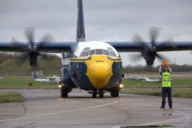
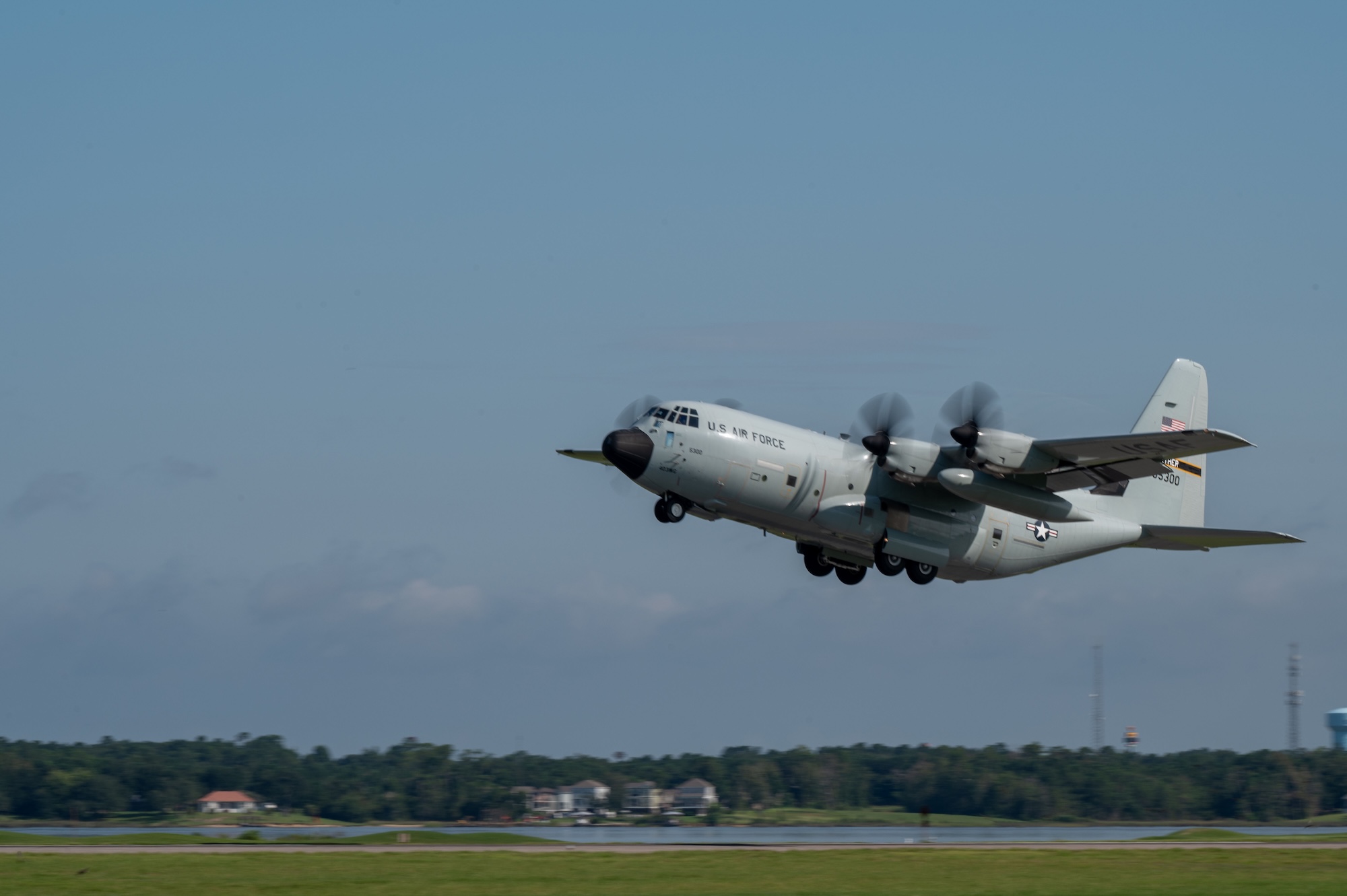
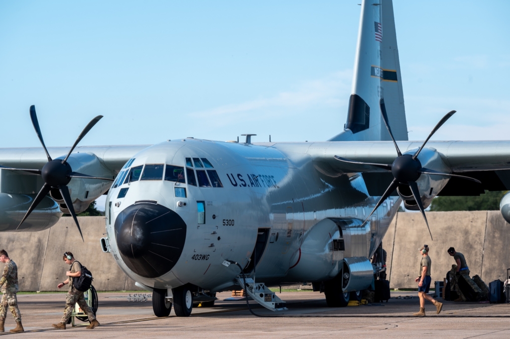
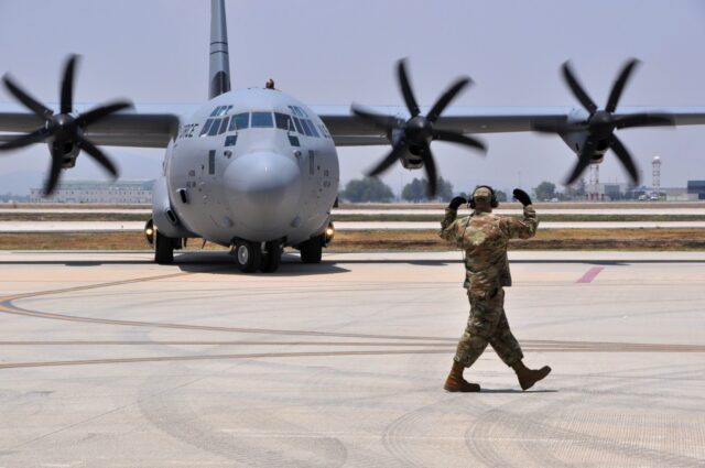
Hurricane Hunters complete intense 2025 season, flying 1,000 hours and tracking 8 major storms

December 3, 2025
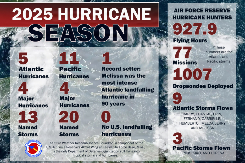
The 2025 hurricane season — officially ending on November 30 — proved once again the vital role of the Hurricane Hunters. The US Air Force Reserve’s 53rd WRS logged 927.9 flight hours across the Atlantic, eastern Pacific, and central Pacific basins, flying directly into some of the most ferocious storms of the year.
From Erik to Melissa: Hurricane Hunters provide life-saving views from the eye of the storm
The Hurricane Hunters’ first mission took off on June 18 into Hurricane Erick in the eastern Pacific. The final mission landed on October 30 after penetrating the eyewall of Hurricane Melissa in the Caribbean.
The 2025 tasking list spanned many named storms. In the Atlantic, notable storms included Hurricane Barry, Tropical Storm Chantal, Hurricane Erin, Hurricane Fernand, Hurricane Gabrielle, Hurricane Humberto, Hurricane Imelda, and Tropical Storm Jerry, culminating in Hurricane Melissa.
In the Pacific basins, crews flew into storms, including eastern Pacific Hurricane Lorena and central Pacific Hurricane Kiko.
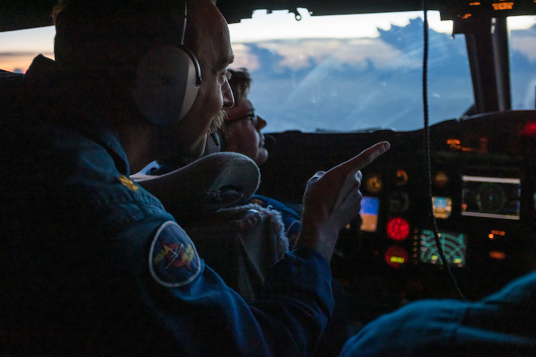
Hurricane Hunters hunt for data
“Our job is to fly directly into the storm and collect vital information such as wind speeds, pressure, temperature and humidity,” said 1st Lt. Mark McCoy, 53rd WRS aerial reconnaissance weather officer.
“While satellites provide a significant amount of information, the data we gather within the storm is unique and cannot be captured from space. That information helps the National Hurricane Centre refine forecasts and gives people more time to prepare.”
The team transmits life-saving storm data in real time to forecasting bodies such as the National Hurricane Centre (NHC) and the National Oceanic and Atmospheric Administration (NOAA).
“Every time we fly into a storm, we’re collecting data that can directly impact how communities prepare and respond,” said Lt. Col. Steve Burton, 53rd WRS director of operations and the deployed detachment commander. “We train all year for this. What we do helps save lives and property.”
The 2025 hurricane season stood out for intensity over frequency
Warren Madden from the National Hurricane Centre said that while the squadron’s 2025 season did not see an unusually high number of storms, the sheer intensity of several made it one of the most challenging in recent years.
The squadron flew into three Category 5 hurricanes: Erin, Humberto, and Melissa.
“What was unusual this year was the overall lack of activity in both the Gulf and in the Caribbean,” Madden said. “We only flew one named storm in the Gulf — Barry — along with two northern Gulf [flights]. Chantal was the only system that produced direct wind impacts to the continental US, and Melissa was the only storm we flew in the Caribbean.”
Melissa set a record as the second sub-900 millibar storm in two years
Melissa was especially noteworthy — a sub-900 millibar storm, making it the second such extreme storm the squadron has penetrated in two consecutive years.
“Three of the systems — Erin, Humberto and Melissa — reached Category 5 strength, and Melissa became the second sub-900 millibar storm we’ve flown [into] in as many seasons,” Madden said, referring to Hurricane Milton in 2024. “That level of intensity in consecutive years is rare.”
The phase of the season that demanded the most from crews came late. As Melissa rapidly intensified over the Caribbean, the team repositioned to a forward operating base in Curaçao on October 21. Over a seven-day stretch, they flew 17 missions totalling 170 flight hours, conducting almost round-the-clock operations to feed data to forecasters as the storm spiralled into a major hurricane.
“That information was delivered directly to the National Hurricane Centre to improve forecast accuracy as Melissa intensified,” Burton said.
Hurricane Hunters fly through US government shutdown
To add to the complexity of operations, the storm came during the US government shutdown, impacting travel, funding and coordination.
“Despite the administrative hurdles, our Hurricane Hunters continued operations uninterrupted, ensuring forecasters received the critical data needed to protect lives,” said Col. Jaret Fish, 403rd Wing commander. “Our Airmen demonstrated the flexibility and dedication that make the reserve force vital to the nation’s readiness.”
Burton added that, despite the challenges, the team maintained its focus on the mission.
“We knew communities were already feeling Melissa’s impact. Every data point we gathered fed into forecasts that helped officials make lifesaving decisions,” he said. “That’s why we do this mission.”
Better forecasting, safety and preparedness
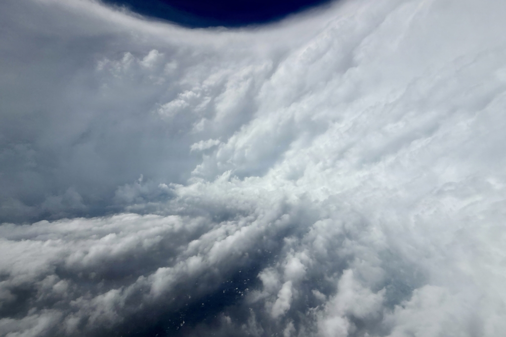
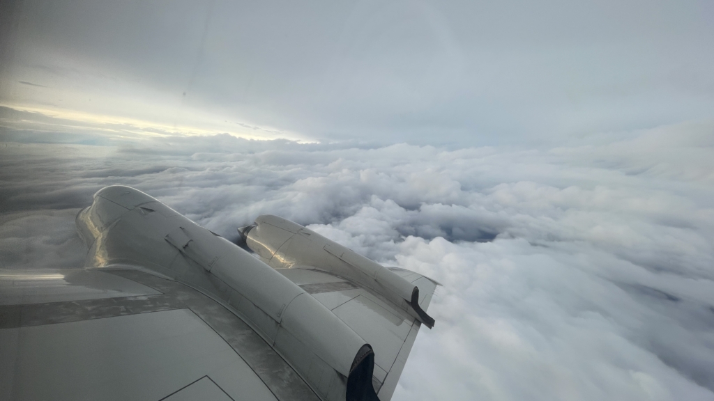
The data gathered by the Hurricane Hunters is critical to improving storm forecasts, which in turn affords coastal communities and disaster-response agencies more time to prepare. Their flights inside hurricanes — especially direct passes through the eye wall — yield high-resolution measurements of storm structure that satellites alone can’t provide.
In the case of Melissa, the increased flight cadence following the Curaçao repositioning provided near-real-time atmospheric sampling under extreme conditions. This data helped refine track and intensity forecasts as the storm threatened vulnerable Caribbean populations.
Hurricane Melissa ravaged the Caribbean with 185-mph winds, torrential rain, flooding and widespread destruction. Jamaica was worst hit, suffering $6 billion to $7 billion in damage, according to estimates from the United Nations and the US State Department. Haiti experienced deadly flooding and landslides, and Cuba endured coastal flooding. At least 90 people died across the region, including 45 in Jamaica, when the hurricane made landfall near New Hope on October 28.
Curaçao’s proximity to Melissa’s centre allowed Hurricane Hunters to penetrate the storm more frequently with higher-density equipment coverage during the storm’s peak intensity. As a result, forecasters and emergency managers could issue more accurate warnings and evacuation guidance.
Beyond hurricanes — an ongoing mission to provide vital weather data
The lesson of the 2025 hurricane season is that even in years without widespread landfalls, real-time reconnaissance remains indispensable. Tropical systems can intensify rapidly, become extremely powerful, and pose serious threats.
With the final hurricane-penetration flight completed on October 30, the 53rd WRS doesn’t simply stand down. The unit is transitioning into winter storm reconnaissance operations, including collecting data on atmospheric rivers over the Pacific. This is crucial for forecasting heavy rainfall and flooding across large swaths of the western US.
“The hurricane season may be over, but our mission never really stops,” Fish said. “Whether it’s tropical cyclones or atmospheric rivers, our airmen deliver data that directly supports national preparedness and disaster response.”
“Their work saves lives, protects property and provides the science that forecasters rely on every day. We’re proud of what they accomplished,” Fish concluded.
Featured Image: US Air Force, Senior Airman Emily Bloodworth


![NASA's X-59 Quesst [registration N859NA '859'] is seen in-flight over California during the experimental supersonic aircraft's brief second test sortie on 21 March 2026. Image: NASA/Jim Ross](https://aerospaceglobalnews.com/wp-content/uploads/2026/03/X-59-Second-Flight-21-03-26-NASA-Jim-Ross-crop-scaled-640x0-c-default.jpg)